


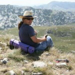

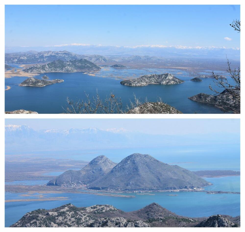
During the winter period, since we are at odds with the snow, we choose tours south of Podgorica. Since we have been walking for many years, it is not easy to find something new that is in line with our capabilities. That's why we often repeat the old, good, never boring rides and walks. One of them is the tour Virpazar - Rijeka Crnojevića or vice versa. Exactly 4 years ago, we repeated this tour from the direction of Virpazar. Most of the time, our first stop is the viewpoint from the hill across from Virpazar. During each season, the scene is different, and there are certainly more beautiful periods than January.
After the viewpoint there is a very monotonous part of the road where you can see nothing but hills on both sides of the road, but luckily it doesn't last long. When we got to the Trnovo sign (it turns left from the main road), we said: "We've never been, so let's see what it's like." Ouch!!! A narrow road leads to Trnovo where there is no passing. On the right, a hill rises directly from the road, and on the left is a precipice, according to subjective feeling, of at least 500 meters. I drove in shock, saying to myself: "Just so that someone doesn't come across, just so that someone doesn't come across..." No one came. We reached the village, turned around and went back at the same moment. You shouldn't go here just to go. It is necessary to make an agreement with someone from the village when leaving so as not to encounter someone from the opposite direction. Although, I wouldn't say that there are many permanent residents left. Photos of Trnovo and the road to it - none. A rare moment when I was so frozen that I didn't even remember the camera. Soon after we returned to the main road, continuing towards Rijeka Crnojevića, we arrived in the village of Komarno. It is the last village on this road that belongs to the municipality of Bar. The very next village is from Cetinje. Komarno used to be a large village and the center for the surrounding villages, in a sense. I concluded that from the size of the abandoned school, which is located on the right side of the road. We saw a yellow hiking sign that said Vrh Komarštik, 1.5 km, 45 min. (Later, I saw that it was written Komaraštik in several places. I don't know if it says both or the authors of the board made a mistake, which is not a rare case). We thought - ideal! We parked and headed between the houses along the beaten path. We calculated - we will manage. But we didn't. We "made a mistake" and reluctantly turned back, continuing towards Poseljani. Four years later, our friends "Local hikers" first posted photos from the top of Komarštik on FB. The view of Lake Skadar was fantastic. A few days later, they published a video about the village of Poseljani, in which Komarštik played a secondary role.
Watching the video, we realized where we went wrong during the previous attempt to reach the top, because the local walkers repeated our mistake at the start. It was a little easier for me.
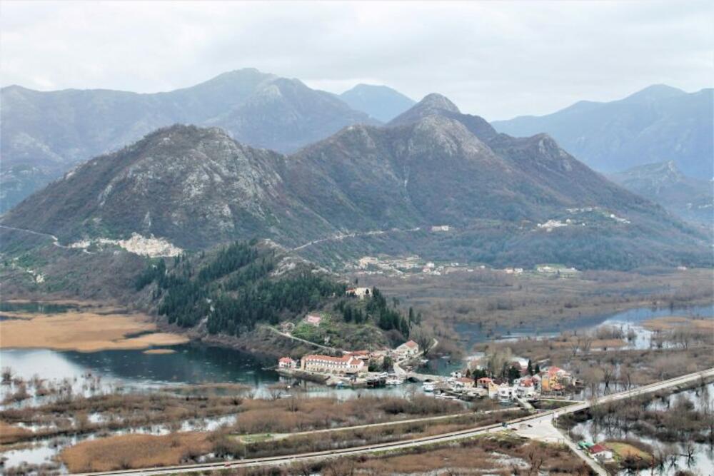
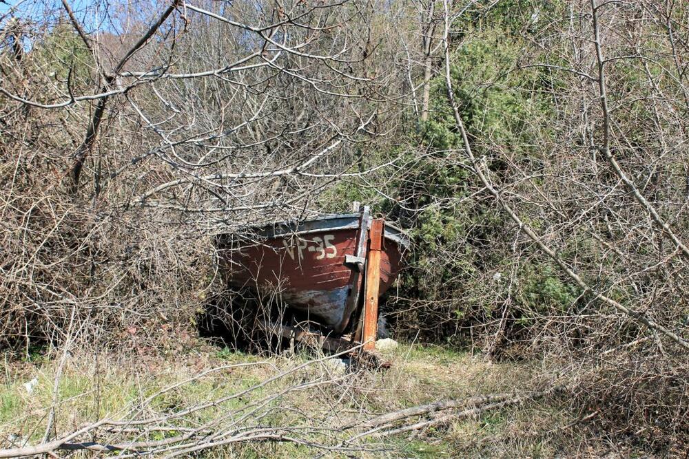
But let's go back to the beginning. In the second half of March, we left in the hope that there would be "other luck" and that we would reach Komarštik. We headed towards Virpazar, then turned towards Rijeka Crnojevića. The mandatory stop by the van-shaped viewpoint annoyed us (as always) because of the garbage, and additionally because the hotel, which is being renovated with its dimensions, completely destroyed the recognizable, beautiful image of Virpazar that I know and love. In addition to garbage, the novelty this time was a boat "stranded" in the bushes.
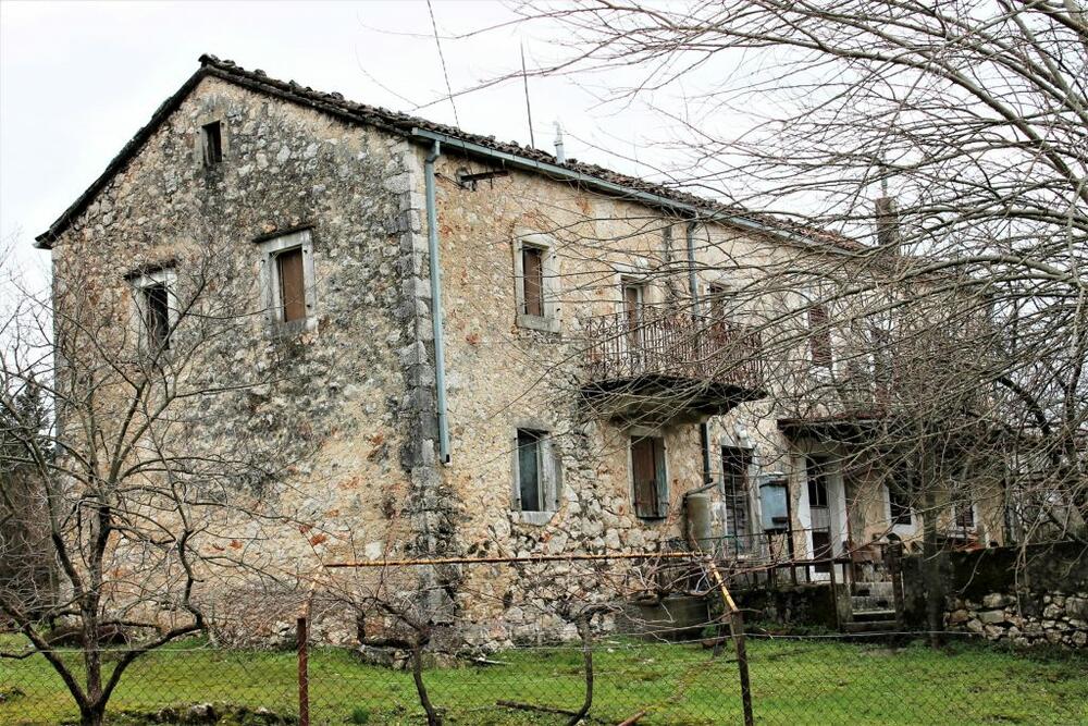
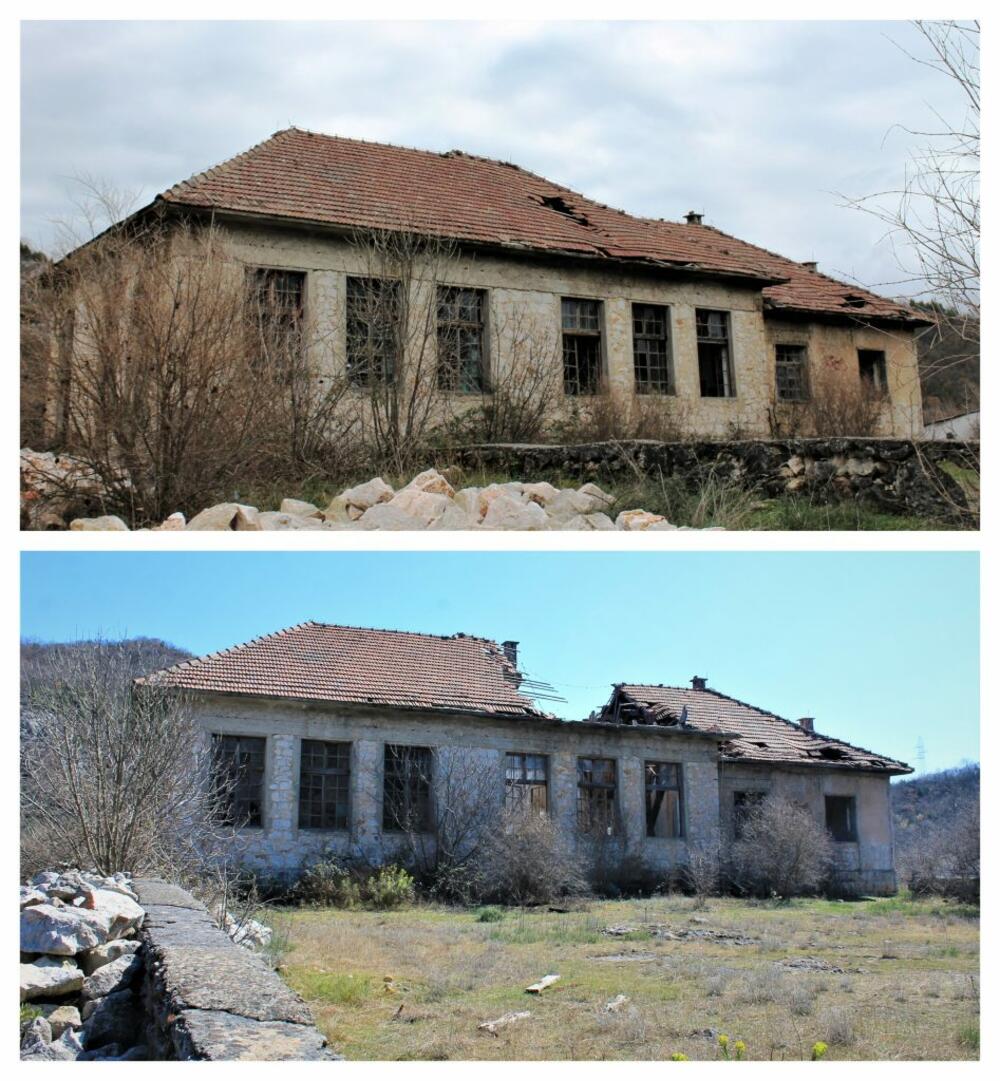
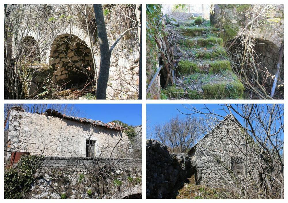
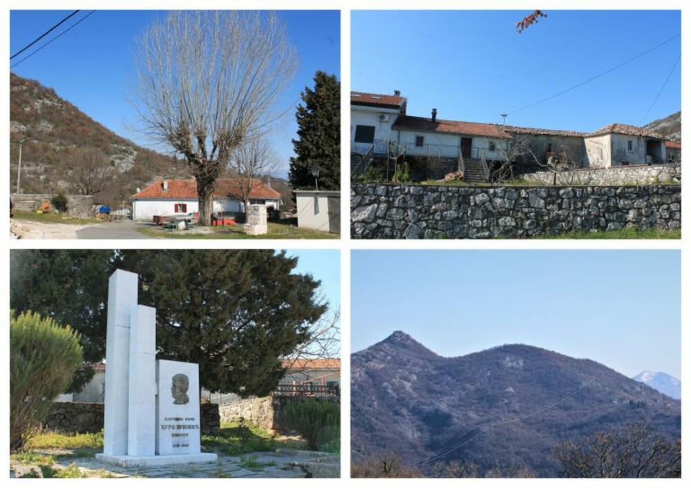
We just glanced at the sign for the turn to Trnovo and continued to Komarno. We parked right next to the road, opposite the pillar on which there was a road sign for Komarštik. The first sight inevitably falls on the wonderful stone house that is located above the road. I don't know when it was made, but it seems like a long time ago. However, it still holds up very well.
In contrast to this house, the condition of the school totally disappointed us. I haven't been able to get information on when this school was in operation and how many students it had in its best days, but its size and collapse speak for themselves. I compared photos from 4 years ago with this year's. It is a question of the day when the school will completely collapse. Scenes like this always make me sad. Has no one found an interest in preserving it and using it at least... for growing mushrooms.
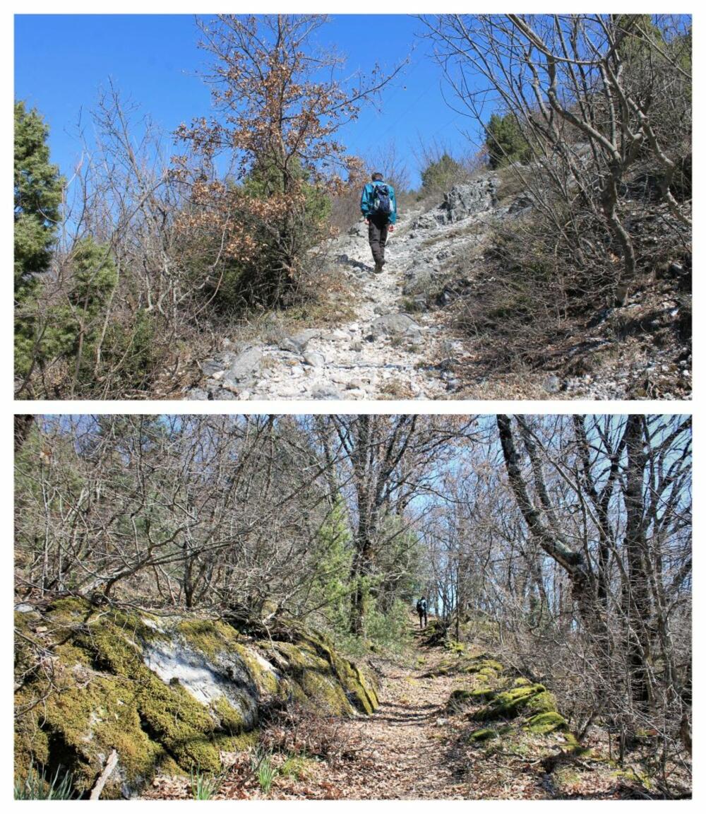
Before we started towards the goal, we looked around. We were pleased to note that it seems as if life is returning to this beautiful and rich village (at least on weekends). The hard-working villagers worked in the fields and probably thought to themselves: "What an idle people there are". The video of the Local Walkers obviously had a good response because besides us there were at least eight other walkers on the summit that day. We took the familiar path between the houses. Now we knew what the problem was, we couldn't miss (at least not the first obstacle). Instead of continuing straight along the path like the first time, we turned right, straight up over a rock. I photographed her last time. At that time, it did not occur to us to go in that direction.
When we rounded the rock and saw the path in front of us, we looked back. Below us lay the village of Komarno. Above it is the Ušitac hill, at the foot of which, on the other side, is the village of Trnovo. There are a lot of houses in Komarno, the only question is how many of them have not been visited for a long time. Something new is being built, and the old is collapsing. School, for example.
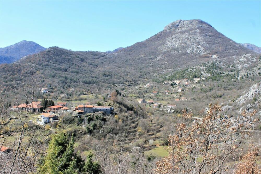
From Komarno, you can see the road winding towards Rijeka Crnojevića. Deep down you can see the village of Poseljani, which we always visit when we drive here (although Duško is against it at the start, because... "we've seen it 100 times already").
After passing the rocky part, a beautiful, and more and more beautiful path appears. It is not marked, but it cannot be missed. It is wide enough, completely safe, leads through the woods and is a real revelation. The stones are overgrown with moss, which gives the path a special beauty. We enjoyed walking along it, surprised by this kind of ambiance in this part of the country.
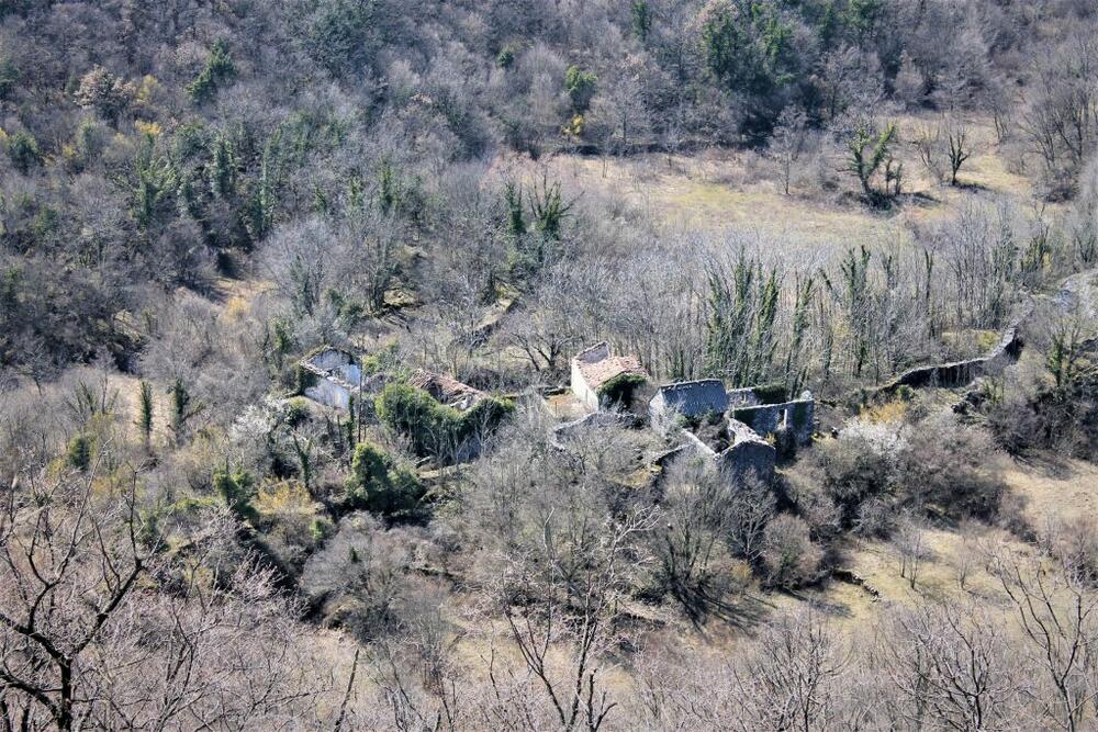
When the path led us to the former settlement, which we later learned was called Razdolje, we realized what often happens during hiking: the goal is on the next hill. We made peace with that and took a short walk between the long-abandoned houses, noticing the well-known parts of the architecture of the old stone houses from this area. We haven't even determined with certainty how many houses there once were: five, maybe six. In any case, they were extremely clustered, which I found a little unusual (as there is plenty of space around), but I have no doubt that it was for some reason that I just couldn't figure it out. I'm guessing that the reason for this is the increase in arable land, because every foot of land is taken away from the stone.
So far this tour has been a song. The trail is nice and easy, the surroundings are very nice. You couldn't go astray anywhere... But where now? The dilemma was not that the goal was a hill rising above Razdolje from the opposite side of the one from which we had just come. We descended under the remains of the first house, crossed a meadow and entered the forest. At first it seemed to us that we were following the path. I regretted that I had brought the best hiking jacket because after every three steps I would get tangled in the branches, but we still made progress.
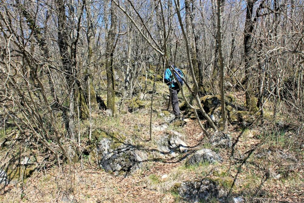
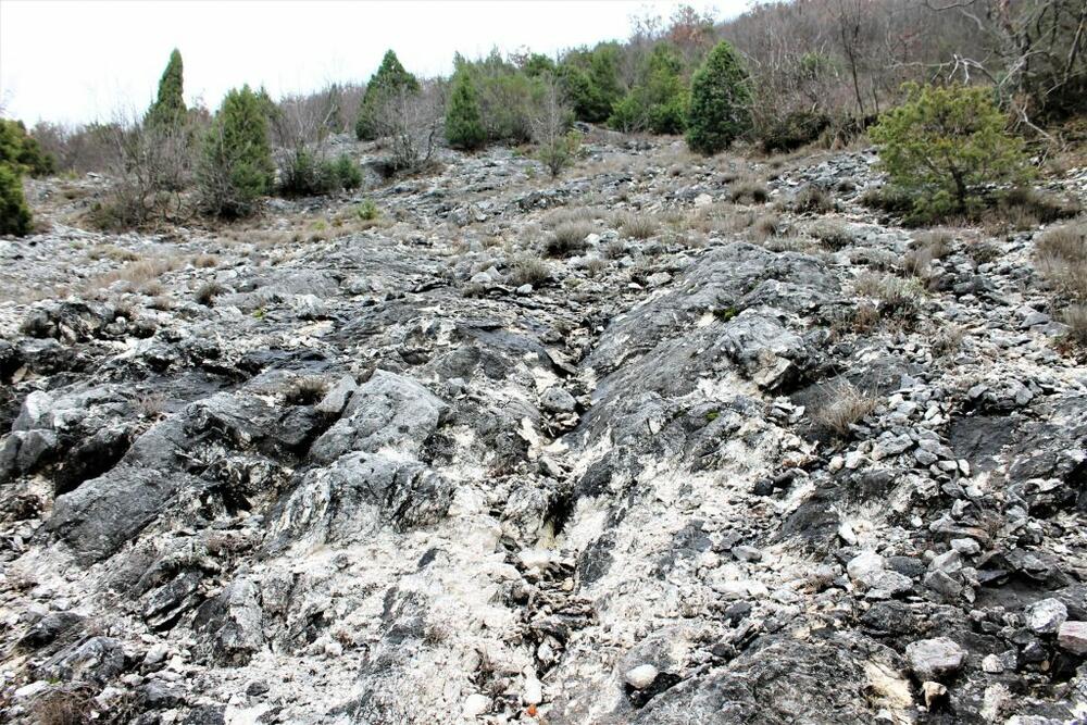
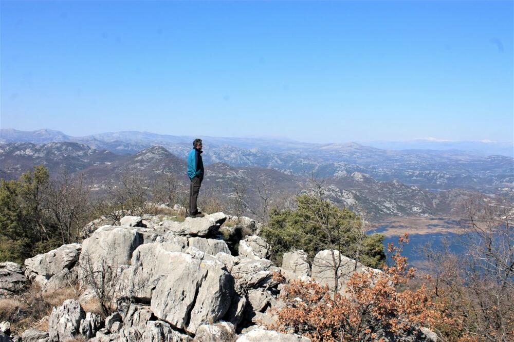
But over time, we only had an occasional glimpse of the path, or it just happened to us. I followed some footsteps, but later I thought: "And who says that he didn't walk randomly like us?". Then the forest path disappeared. In front of us were piles of rocks which, worst of all (and unusually), were completely unstable. I said to myself: "I will not recommend this track to anyone. We are experienced and know how to handle stones, someone can get angry." Fighting to keep some rock from falling away from under my feet and plummeting down with me, I thought that it would be very good if the path was cleared a little and marked. Seems like a good idea for a future project. Duško and I developed into shooters in an attempt to reach the top. Everyone climbed in their own style and in a different direction. He arrived first. When I finally got out and reached the finish line, I was taken aback (despite previously seen photos and videos of the Mandić couple - Local walkers mentioned several times). I had to admit that in the too strong competition of viewpoints overlooking Lake Skadar, this one immediately took the place of honor.
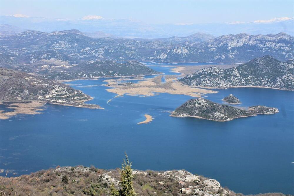
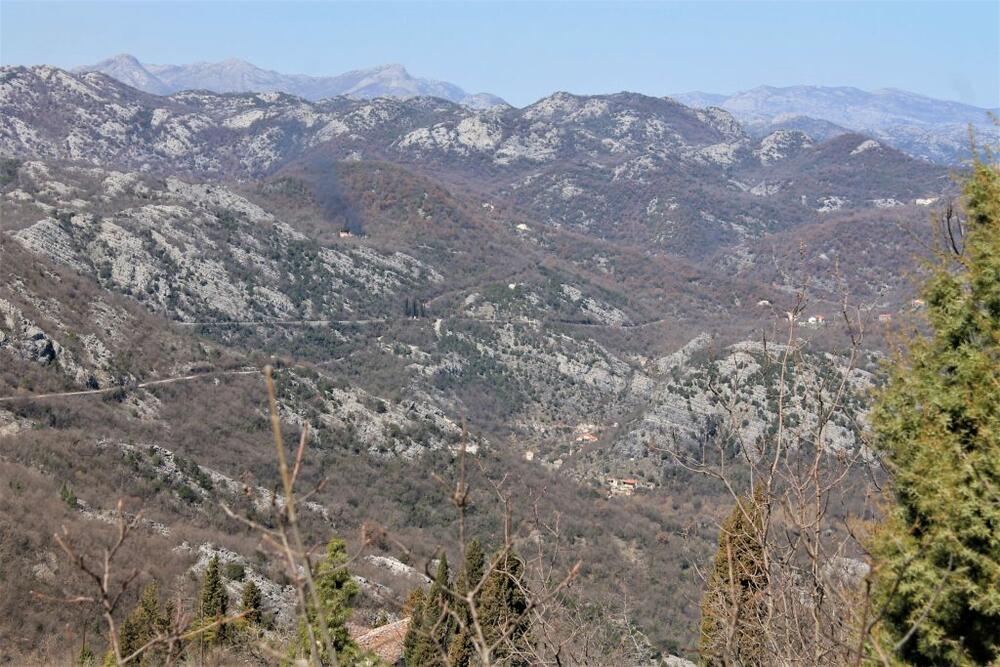
A lot could be seen from there. As always: we were completely sure about something, a little less so about something. The village of Prevlaka, which I have already written about, and which is located on the island of the same name in the lake, could be seen beautifully from here (left in the middle). However, there was no idea that he was on an island because another island stood between us and him. Some less pleasant things were also seen, such as the "Porto Skadar Lake project" started (one of the more harmful ones, in the sea of harmful ones), which, I hope, will remain just a crazy idea. We spotted both Little and Big Bobija, guessed where the newcomers are. Garač, Lovćen and Štirovnik could be guessed. On the other side, Žabljak Crnojevića could be seen. Vranjina was to the right of us, and in the distance Prokletije was whitened. In the lake we saw numerous smaller and larger islands that I had not noticed in such a large number before.
Vrh Komarštik is anything but "harmless, grassy, spacious" as can be described for most of the peaks we've been to so far. He is the complete opposite of that. But that didn't stop us from "walking" around it in an attempt to see the surroundings as well as possible.
While I was jumping from rock to rock with exclamations of delight, I couldn't help but think how I was going to get down (“poor mother”). I said: "No one forced you to climb, Jasna." Just slow and careful.” Before we started back, I took a look at Razdolje. From above, you can see even better how the houses are huddled together.
I've noticed that it often happens that what you fear the most, passes unnoticed. So the descent, especially when compared to the ascent, almost didn't even register. In the blink of an eye we were at Razdolje, and the descent to Komarno was a song. Along the way, we talked about what a hit tour this could become with a little investment in trail marking (and the work that goes along with it).
As I said, you cannot go from Virpazar to Rijeka Crnojevića without stopping in Poseljane. We calculated that in March the waterfalls in the village should be beautiful. It was only when we saw how little water there was that we realized that our hope was unrealistic because there was almost no rain this winter. Fortunately, I have numerous photos from this location, and I had those from January 2018 handy. So, if you go to Poseljane, do it after some heavy rains.
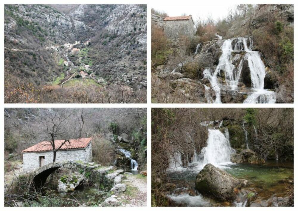
Whenever we went towards Poseljani, we would notice a group of houses towering over them. However, in all this time we have never gone to see which village it is and what it looks like. That day we decided to make it right. When we returned to the main road from Poseljan and headed towards Rijeka, we carefully watched not to miss the turn for that village. Somehow it took too long for us and when we thought that, I don't know how, we managed to miss the turn, it appeared: the village of Čukovići. Not far from the turn, we came across the first village houses. At first glance, we really liked the Čukovići. Everything under a thread: tidy, orderly. In front of a large tree in the center of the village, next to the hut, a fountain, a table and chairs. Not far from there is a monument to the Spanish fighter Đuro Vujović, a Spaniard who died at Tjentište. I thought he came from that village, but I read that he was born in Ljubotinje. In any case, for me, this is an exceptional gesture by the residents of Čuković. I admired the stone houses, and then I looked to the southeast and across the road I saw Komarštik! It is only from this perspective that one can clearly see how it climbs from Komarno to a hill, descends to Razdolje and finally reaches it. At that moment, our friends Sanja and Peđa, whom we passed near Razdolje, were on top. We waved them off, but still called them on the phone to tell them that.
Čukovići was an unexpected addition to the tour that compensated for the disappointment of the lack of water in Poseljani. We headed slowly towards Rijeka, thinking that the surprises had come to an end. However, as soon as we continued along the road, we were surprised by the crowd and the tables and chairs placed next to the road itself. The view of Lake Skadar was spectacular, especially since it was not from a peak but from the road. I wanted to stop for a moment and take photos of that side of the lake, but there was no way. Numerous cars were parked on the left side of the road (and new ones were constantly arriving), while there were tables on the right side. Stopping in such a crowd would also mean clogging the flow of traffic. We continued on, shocked. What is this about? Thanks to the Internet, we discovered that it is a new iconic place for young people to go out, primarily from Podgorica and Cetinje, but also others: Macal's hill. As if through a fog, we remembered that our son had told us about it, but we were not careful listeners. We left Macal's hill to the young people, and we stopped at the eco-restaurant Šinđon in the village of the same name, where we drank excellent tea with local honey.
Returning to Podgorica (we didn't stop in Rijeka Crnojevića because we went there a couple of weeks ago), Duško decided to take the road from Pavlo's side towards Meterizi. It is one of the three roads that lead from the Podgorica-Cetinje direction to Rijeka Crnojevića, and which we always bypass somehow. We weren't even sure if the road was in operation. It is. We reached the main road quickly because we didn't pass anyone. When we reached the second serpentine, we had to stop. And from here there was another fantastic view of Lake Skadar, which I claim is our most photogenic. That was the end of the delights of our beautiful country for the day.

Bonus video: