


Mount Sinjajevina has been undeservedly neglected by nature lovers for years. When the Ministry of Defense decided a year ago to turn the "largest pasture in Europe" into a military training ground, many protested. First of all, those who live from Sinjajevina, that is, those who graze cattle in this area in the summer, and they were joined by those who want "Ecological Montenegro" to be a reality, and not a dead letter on paper. Fans of Sinjajevina have won a lot of battles so far, but they are still distrustful and are not sure that they won the war. I hope that will happen soon.
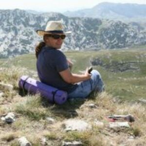
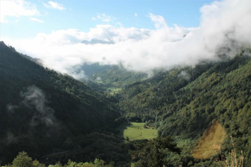
Only, the "defense of Sinjajevina" and the great media attention that accompanied many events, caused great interest in this mountain. The intention to get to know her is probably the main reason why we replaced our beloved Toyota Yaris with a Duster, because in Sinjajevina it's hard to live without an off-road car. During our first meeting, two summers ago, we mostly drove. Sinjajevina, for our purposes, occupies a large space. It is 35 to 40 km wide and 10 to 15 km long. It is located at a relatively high altitude, an average of 1600 to 1700 m, and has numerous peaks that are relatively easy to reach, once you climb Sinjajevina. During the first ride, I said: Next time we will go to Jablan's peak. He seemed relatively accessible and excellent to me. But that first summer, followed by autumn, sprung and I put Jablan's peak on the list for the following year. In the meantime, I watched an interesting show on RTCG in which two of my FB friends, Brko and Mićo, climbed this peak, which strengthened me even more in my intention to get there. The most important question was: how to get to the starting point. There were various proposals. I cheered for the approach from the Krnja Jela side. Duško completely rejected the idea of going via Vratlo, and in the end, Sanja and "the road made by the army" to Sava's water won out. We planned to "attack" Jablan's peak from there. The proposal was accepted. We headed towards Kolašin and about 2 km after it, in the village of Bakovići, we turned towards Lipovo. Somewhere to the right should have been the road leading to the Sava water, but we obviously started paying attention too late because from the moment we opened our eyes and turned our neck to the right, there was no way to turn. And so, step by step, we reached Gornji Lipovo and the beginning of the climb to Vratlo. We had no choice, we had to go there. The first time this road was quite stressful for us, but that day we overcame it easily. Again, like the previous time, we stopped at the bend to admire how far we managed to climb. Thanks to this road, we climb about 700 meters in height.
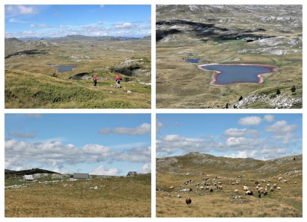
We reached a valley called Smrdan, but we didn't stay. We immediately turned right towards the Grkovo lake and katun. It rained a lot in the previous days, and it seems to be above average on Sinjajevina. We drove on a stony macadam road that was "strewn" with dirt in places. That country was so muddy that we often danced on the road, which was not pleasant at all. Fortunately, the drive to Lake Grkovo was short. We passed here last summer when we were trying to get to Žabljak, but we didn't see the lake because it's a little further from the road. This time we paid attention because the ascent to Jablanov vrh starts from the lake. The lake is artificial, made as a reservoir that serves to feed livestock. The grass was so wet that my feet, even with my boots, were soggy before we even started to climb. We were determined that nothing would "spoil this day" for us.
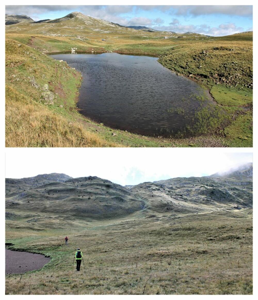
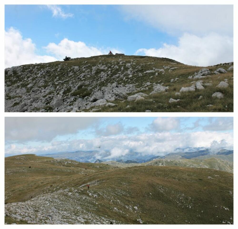
We tried to follow the instructions from the text on the Peaks of Montenegro page. We were accompanied by Sanja, who had already climbed this peak, but she had a guide, so she didn't really pay attention. But, with joint efforts, we approached the goal. Soon we were looking down on Grkovo. Rocky and grassy terrain alternated, steeper and less steep parts. All in all, I don't remember any climb falling more easily for me, even though it wasn't marked. It didn't even bother me that it turned out that the first peak that appeared was not the right one, because this one was not far from it.
We were in no rush. We looked around, admired the surroundings and took photos. We kept our fingers crossed that the clouds obscuring Durmitor would hurry up a bit. Duško was the first to reach the top, and the two of us soon joined him. As the numbers are relative. Jablan's peak is 2203 meters high, and we climbed 423 meters from Grkov. Ever since I've been hiking, and it's been many years, I don't remember getting to a peak being easier. It is certain that the weather conditions, that is, the ideal temperature, contributed to this.
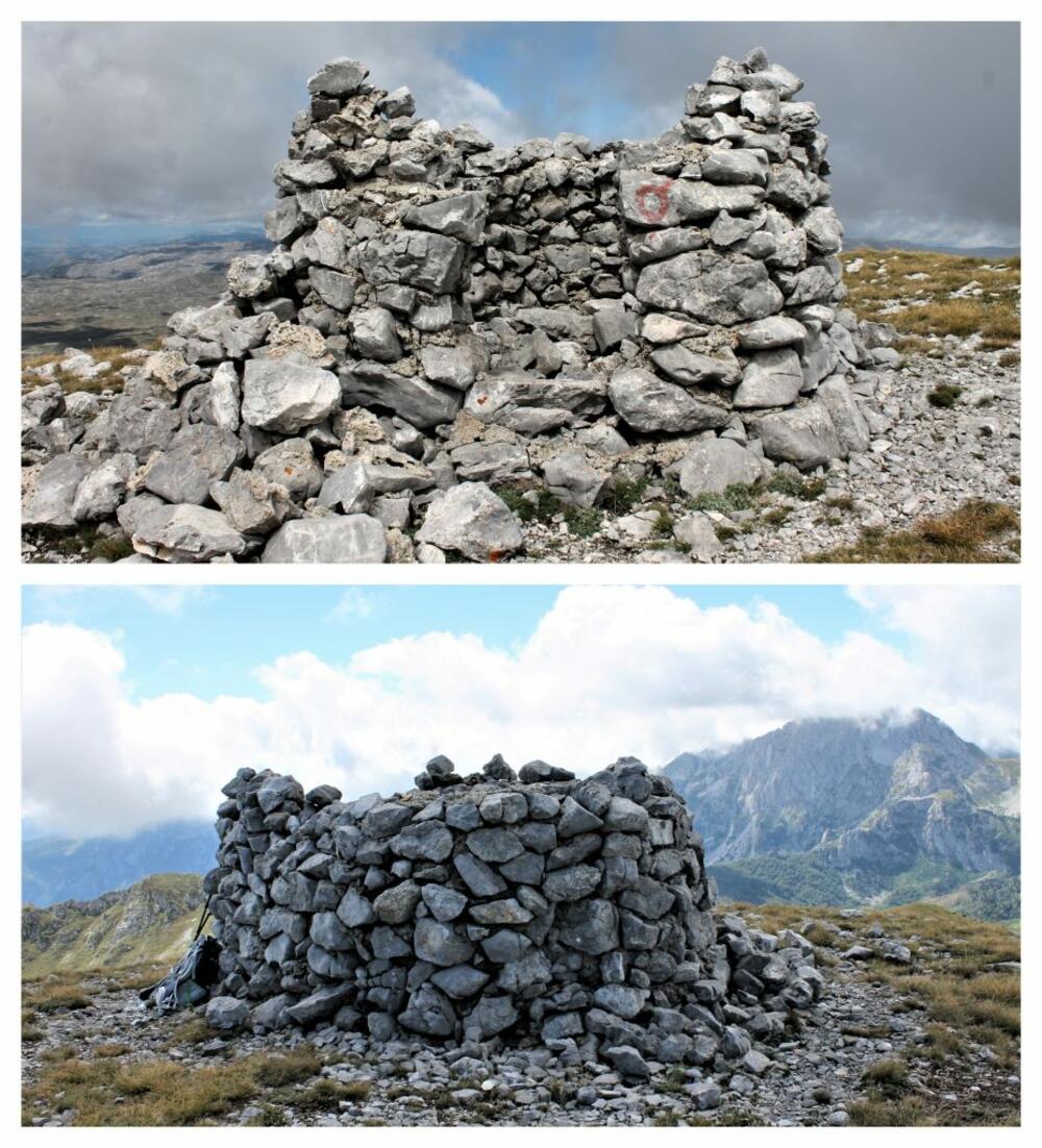
At the very top are the remains of a long-abandoned "project". Someone was planning to build himself a mausoleum or something. How did he come up with that idea, how did he manage to build what he built and, in the end, why did he give up and not follow through with the idea? I would like to know the answers to these questions. I don't know them yet.
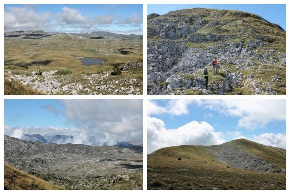
It was a bit cloudy, but the clouds were moving, so I hoped that we would have a chance to see what we were interested in. The unjudged starting point under Sava's beam, as well as Sava's beam, were seen the best. It seemed that Torna and Gradište were very close, although in reality this is not the case. Sanja immediately told us everything about those two climbs, which seemed demanding to me. She convinced me otherwise, so I decided to at least put Gradište on the list in the "eventual" column. Many peaks of Sinjajevina were visible. The pirate was already on our joint list and is waiting for his turn.
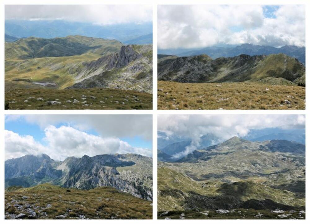
In the distance, as the cloud moved, we could see Durmitor better and better. The red beam was the most conspicuous. We also saw Prutaš, Savin kuk, and Šljeme. Only one was clearly visible to us, and the unusual peak was very disturbing. What could it be? In the end, we realized: It's a saddle beam, only viewed from an unusual perspective. Then all the dice fell into place and all the peaks of Sinjajevina were in vain when we completely switched to Durmitor.
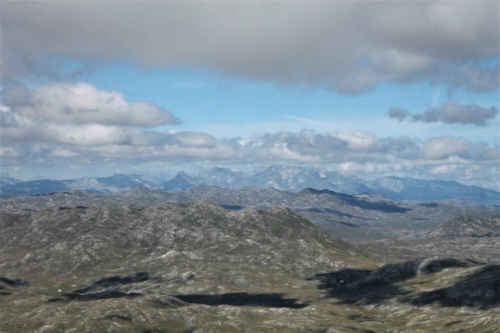
Jablan's peak is extraordinary. Climbing it is almost a walk (if someone teleports you to Grkovi), and the view from it is phenomenal. The central position of Sinjajevina allows you to see at least half of Montenegro from its peaks. If you are lucky enough to go there on a bright and clear day, you can see, apart from the numerous peaks of Sinjajevina, Durmitor, Bjelasica, Komova, Moračka planina. As we were going down, we saw a large herd of sheep going to the watering hole by the lake. The sight was surprising and encouraging. Until then, I mostly met cows on Sinjajevina. The first time I saw a herd of sheep and this many. During the descent, we kept taking turns looking at Durmitor, at Lake Grkovo with the inevitable Little Old Man in the background. There are several cabins near the lake. The sheep grazed peacefully, but we failed to notice shepherds or any sign of life in the huts.
As we approached the car, there was a big discussion about which way to go back. The descent via Vratlo was rejected. The direction towards Krnja Jela was almost certain if I didn't remember how everyone was praising and thanking for the repaired road from Ružica church to Štitarica and how that road is probably the best. To our distress, I prevailed: He accepted my proposal. We drove this way last summer. He was bad, but on this day D... Not only was he desperate because of the mud, but in places it was not even there, so we were guessing where to go next. Only 5 km from Grkovo to Okrugljak katun seemed like 50, brother to brother. Duško cursed, Sanja and I wisely remained silent and occasionally sighed. It's really amazing how in a short time, if not used, the road is almost lost. When we finally reached Okrugljak, it was as if we had arrived home. We continued towards Štitarika, having neither the strength nor the will to stop anywhere else. But the katuns we passed were so cute that Duško, still angry as a lynx for listening to me, still stopped to take at least one photo.
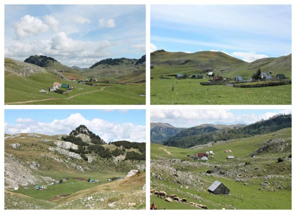
When we reached Štitarica by the road that was partially damaged by the heavy rains, so it was not as good as I claimed, we breathed a sigh of relief. When we got hold of the first tavern, we remembered only good moments and were already making plans for the ascent of Gusar.
Bonus video: