


It was only in the last ten years that I started to get to know the beauties of Piva. No matter how many paths I have traveled in that beautiful part of our country, I would always have one more left. At the start, I concluded that the trio of BMV: Bioč–Maglić–Volujak was realistically outside my "mountaineering category". In addition to the already told stories about Škrčki jezeri and Raklje, which I originally thought belonged to Durmitor, the stories about Piva, Trnovački and Stabanski lakes, I also wrote a series of five stories about what can be seen in the Nature Park a year ago. Beer. I thought that I had covered everything that was within reach of my feet and that I had put an end to the story of Piva. But something new always emerges.
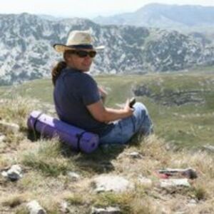
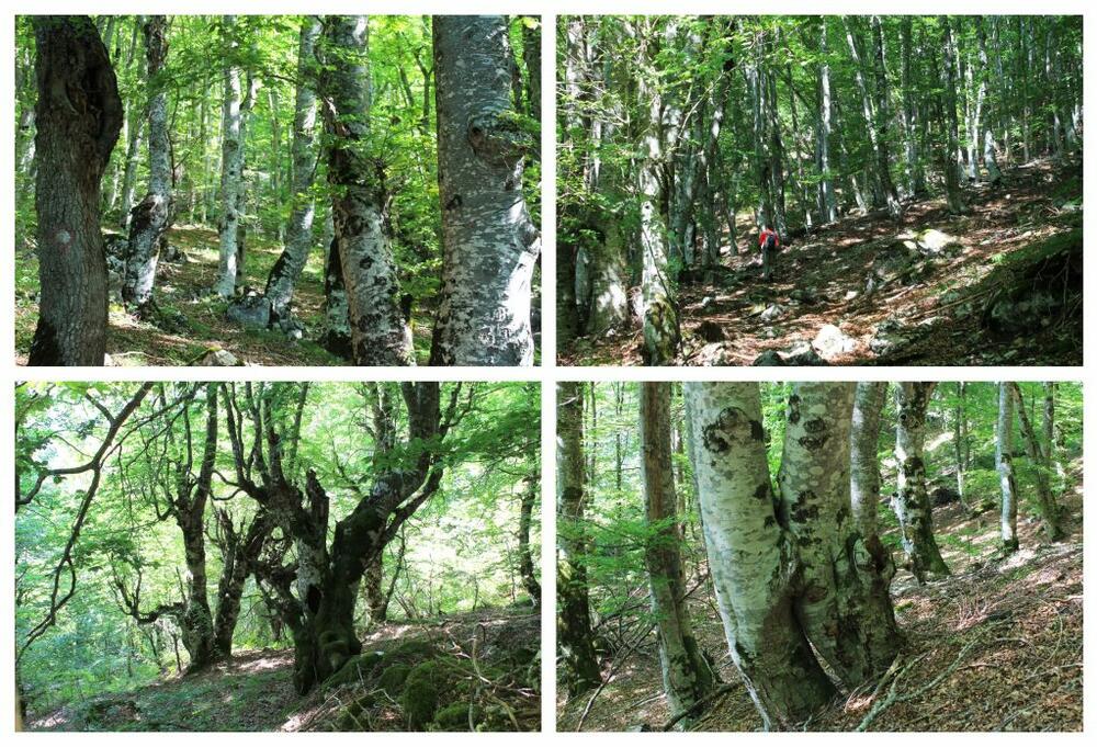
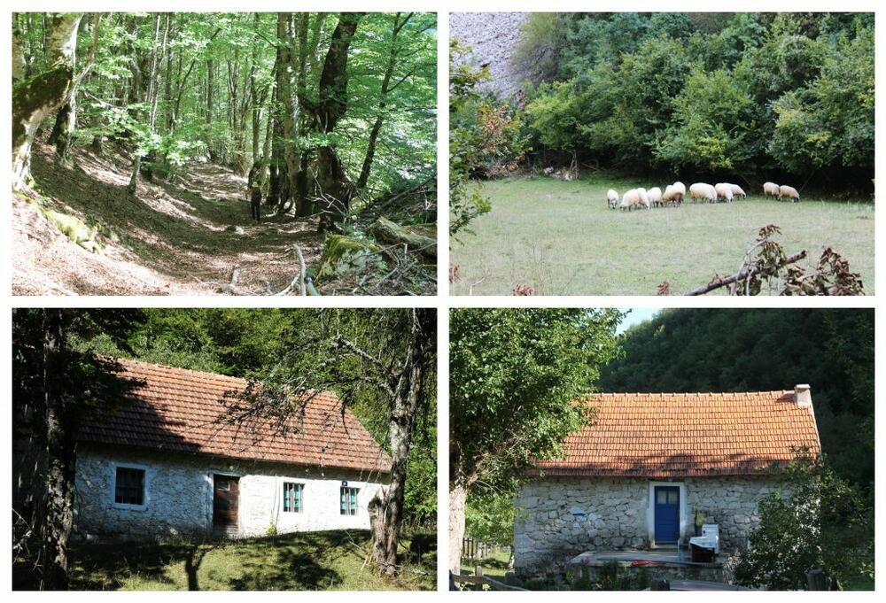
While visiting the village of Gornja Stabna some years ago, I saw a yellow hiking sign indicating the beginning of the trail to Kručica. That tickled me, but I found out that the height difference to it is 720 meters, which was unattainable for me at that moment. Looking in that direction while climbing Zarišnik, I mistakenly thought Suvor was Kručica. I vowed to climb it sometime and put it on the list. Even when I saw stećaks on social media in the photos from that ascent among mountaineer friends, Kručica began to be seriously considered. Sanja didn't want to miss this climb either, so we agreed on dates until the beginning of September this year. By car, we reached the starting point in the village of Gornja Stabna. The last part of the road is steep and we barely found a place to park. The track is circular. We immediately entered a beautiful forest. We were delighted with how it was preserved. I guess that steepness is keeping her safe. It is difficult to reach her.
When we came out of the forest, we found ourselves at a viewpoint from where the villages of Donja and Gornja Stabna could be seen as if in the palm of your hand, and much more that we didn't really know how to identify with certainty.
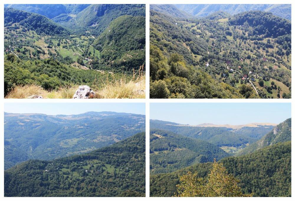
The path then began to turn to the left, and only then did I realize that the view of Pivsko jezero and Plužine that I had hoped for would be nothing. Sanja climbed Suvor before, but she had a guide and she couldn't remember which side they climbed from, but she remembered that it wasn't very easy. "I wish I could somehow succeed. I will put him on the list for next summer". Only then, going to the left, we passed through an incredible landscape. I'm sure that in the spring and early summer, this plateau, because Kručica is a plateau, looks completely different. Then, at the end of summer, with the uncut dry grass, everything seemed unreal. We were enchanted.
"The local population calls this mountain plateau, which is the southernmost part of the peak area of Bioč, the mountain Kručica. Calling individual slopes or the sides of a larger mountain a mountain is common in the Dinaric area, especially in regions with a herding tradition, where shepherds with their cattle were raised to a certain altitude area, i.e. mountain and pasture, and they stayed there during the summer, and often called the area of their rise and pasture a mountain. Individual slopes, mountain sides and grazing areas are called mountains, regardless of the actual morphology of those mountain areas." (www.dinarskogorje.com)
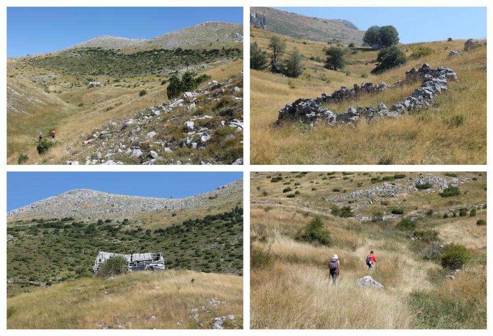
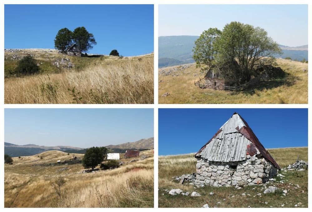
We reached the Stabanski katun easily, without feeling tired even though we climbed those 700 meters. At first, we encountered only ruins or even only the remains of foundations, and then here and there we would see a house wedged between two trees that managed to survive on this tree-poor plateau. We also passed by the source. On the flattest part, we came across several houses that looked as if they were still in operation. Next to one of them we saw several horses, the first sign of life we encountered from Gornja Stabna. We passed each other from a distance so as not to disturb them.
So far the markings were good, but they kind of evaporated from here. The next point we had to reach was Mramorje, the place where the stećci are located, of which Sanja and I have been big fans for a long time and which were one of the reasons for going on this tour. Everything was flat and wide. In order not to miss them, we developed into "shooters" and this tactic proved to be good. Duško was the first to reach them. There were about twenty of them, but one stood out for its position and beauty. A metal plate with the inscription "Tufegdžić J. Marko (1867-1942)" stood on one of them. It's a pity that I didn't have anyone to ask if they knew anything about how Marko died and why he was buried here.
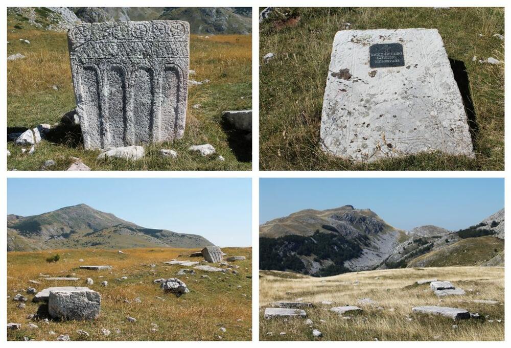
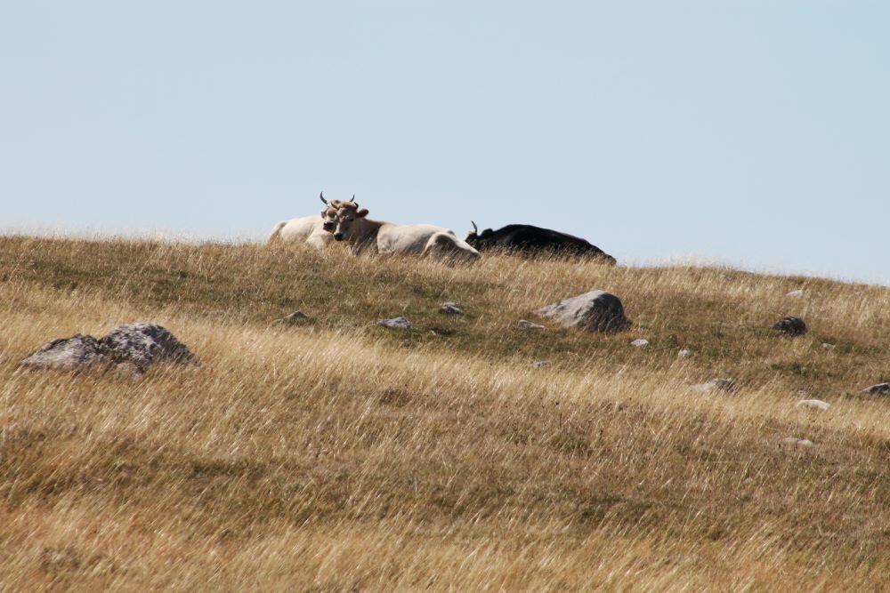
We stayed quite a while on the Sea of Marmara. We photographed each individual stećak from all angles, and then as a group from various sides. From a certain distance, we were watched with amazement by three cows lying down ruminating.
As I said before, this is a circular path. The path, whose markings from Mramorje were again visible, continued towards Stabanski jezeri. We were 6,5 km away from the village of Stabna. We passed by the spring of Zemunica, near which I first saw the large, round rosehips. From there, we started to descend to the Great Staban Lake. When we saw it for the first time, we were delighted. The color of the lake and its surroundings were a sight to remember.
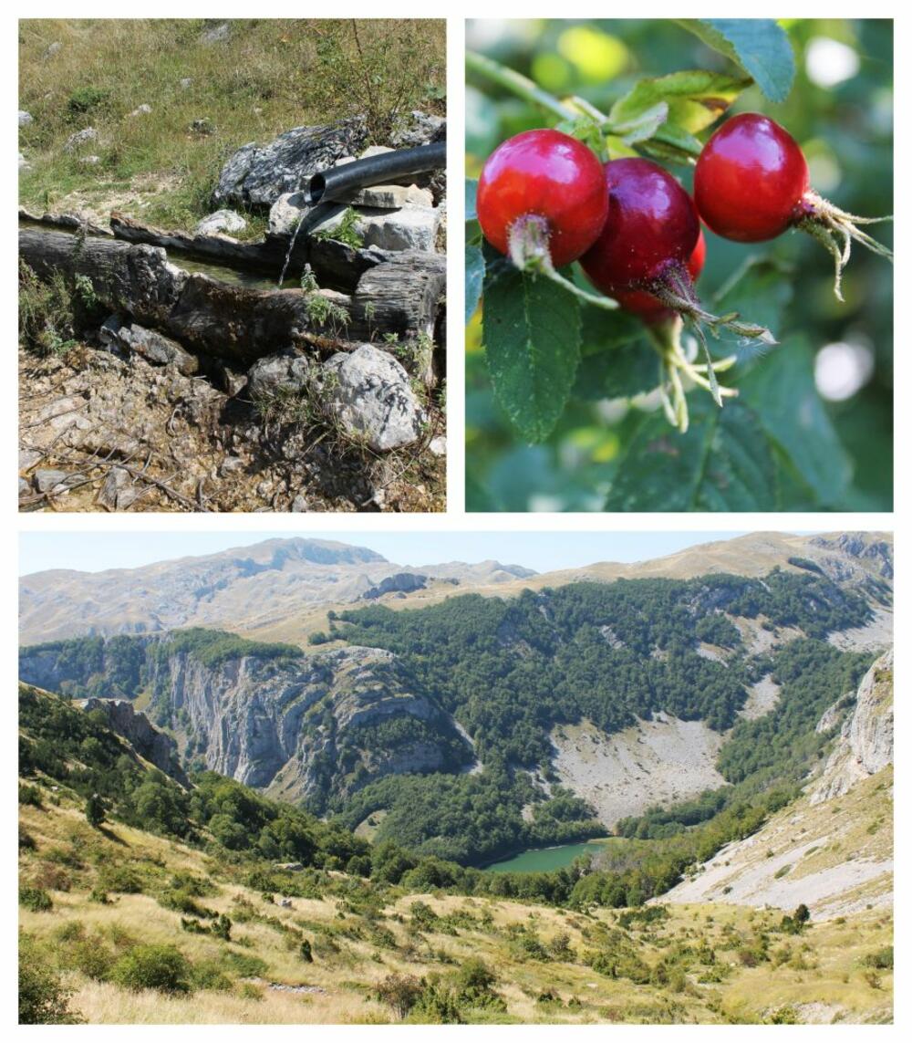
We didn't stay at the lake because we visited it several times before. We continued towards the village. Malo Stabansko jezero is located a kilometer from Veliki, which is not very representative at this time of the year. We have seen it in better editions. The path from Staban to the lake (and vice versa) is one of my favorite walking paths. No matter how many times I pass through it, I am happy again and again with every tree, clearing, old house.
This was no small effort for me, I must admit. When we reached the village, Sanja and I lay down in the shade by the side of the road, and Duško went up to the upper part of the village to drive the car. We waited for him for a long time, thinking that he had sat down with the host, next to whose house we parked for a glass of conversation. It turned out that the road was being built, so he waited for the car to pass. On the way back, we stopped in Plužine for coffee. As always – we looked over the completed tour thinking about the next one. Last year's tour north of Podgorica brought us to these parts again. We climbed to the highest peak of Piva Mountain, Ružica. I doubt that, apart from Suvor, which is already on the list, by the end of this year, no other toponym from these parts will be added to it.
Bonus video: