


In winter, my walking tours are moved to the area south of Podgorica. There is always a path that we have not taken before. Hard-working mountaineers are constantly marking new or repairing old trails, so it never happens that I have nowhere to go, but are just wondering what to choose.
At the beginning of December, a dry and clear Saturday finally dawned, so we discussed where to go. Two proposals made it to the finals: Goli vrh, which is located on Paštrovska gora and in a broader sense belongs to the massif of Rumije and Kuliješ, one of the peaks of Lovcen.
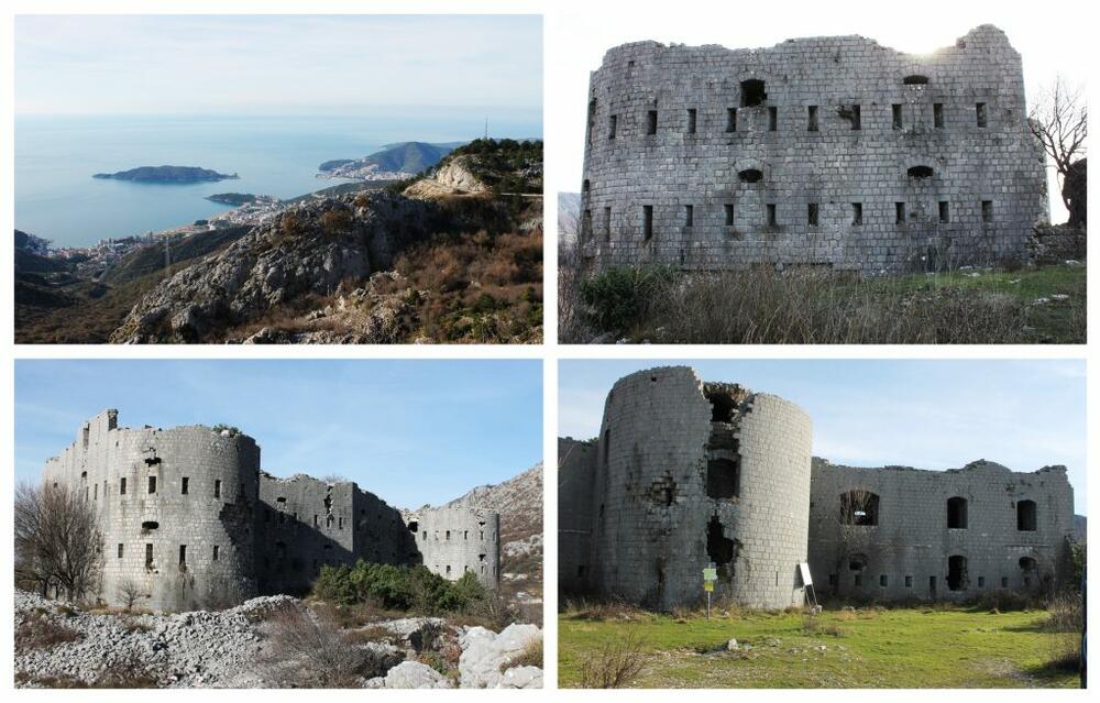
In the end, the trio: Sanja, Duško and I headed to Goli vrh. Traditionally, we prepared by reading the instructions - the text from the Peaks of Montenegro page. Only 322 meters of height difference! It was below Sanja's level, and that's exactly why I gave him an advantage over Kuliješ. "Just to spend some time in the air and stretch my legs", was my humble plan. I wasn't ready for any bigger efforts. We reached Brajić and turned towards Kosmač fortress. We have been to it before on several occasions and always came back sad that a building like this was completely left to the ravages of time. From the plateau in front of the fortress there is a beautiful view of the coast from Bečići to Budva. You shouldn't get too close to the fortress, and don't accidentally enter it either. At least it seems so to me. Kosmač is one of the fortresses from the time of Austro-Hungarian rule over this part of our country, at the end of the XNUMXth and the beginning of the XNUMXth century. I wrote a lot about fortresses. No matter how many times I come to one of them, I wonder again how not a single decision-maker from the end of World War II until now has done anything to preserve these buildings. I'm afraid it's already too late for many, and Kosmač is one of them.
We continued by car for another 2,5 km on a solid macadam road. The hike starts where the road ends. We parked the car next to an old well. Opposite it is a more recent house. The day was perfect for hiking. We followed a path that an experienced eye immediately registers as part of a network of roads that connected fortifications from the Austro-Hungarian period. The road continues towards Ograženica and Velje Kosmač and is part of the Primorska mountain transversal (PTT) that connects Orjen, Lovćen and Rumija. The track was partly damaged, but we managed it easily until the moment when we had to leave it. Namely, when you reach the foot of Goli vrh, you leave the marked trail and continue freestyle.
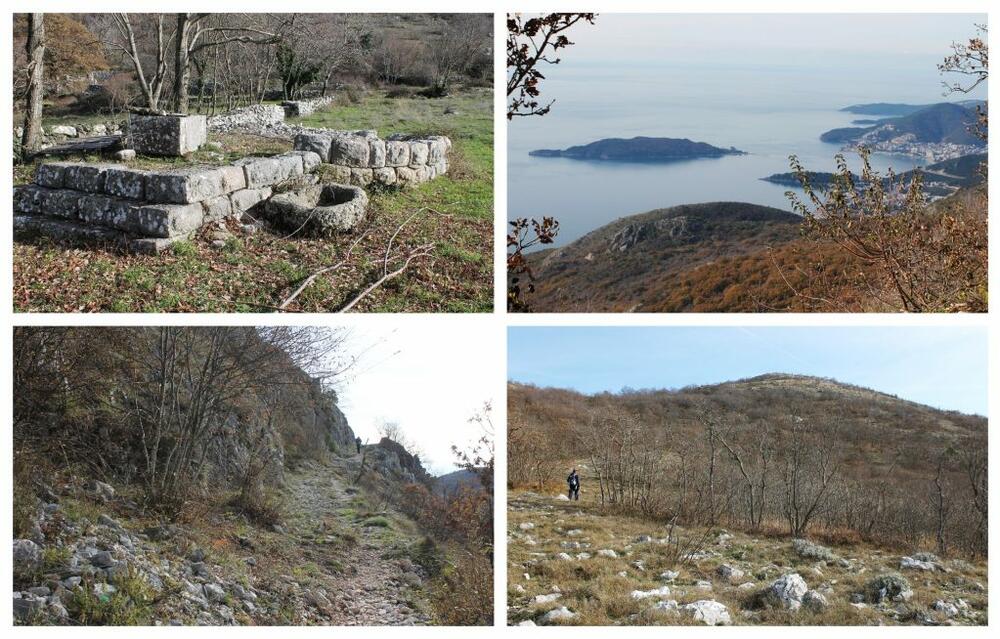
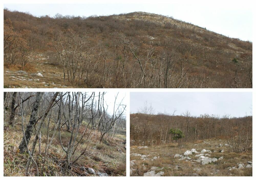
At the point where you turn left from the main trail, there is an old rusty red sign that shows the direction and time needed to get to Ograđenica and Goli vrh. We turned and then started breaking through branches, stones, grass... The combination of stones and grass represents the greatest danger for a potential sprained leg. Fortunately, we all had goiters. I don't think you can move on this kind of terrain without them. Each of us chose the path to the top at our own discretion. Duško always has a separate direction, while Sanja and I usually stay close to each other. Sometimes he reaches the finish line first, sometimes the two of us. We are not competing, but still, I have to say that this time he was first. The beginning of the final part of the climb was unexpectedly difficult, while at the very end it was much easier, so we had the will and strength to look around. On one side the sea, behind us Lovćen. We also located Kuliješ. We concluded together: "We definitely have to get to him." Sanja hoped that when we got down from Goli vrh, we would head straight to the opposite side. I couldn't help but laugh out loud at her optimism. "Another time, Sanja!" We didn't know then that Kuliješ would be our next tour.
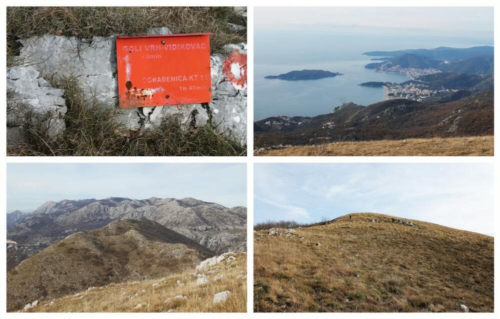
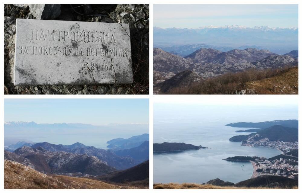
On Goli vrh (1087 meters above sea level) there is a metal cross, it seems to be of recent date, and a marble slab on which is carved: "To Paštrović, For the souls of the dead, 1381." I haven't been able to find out what happened then, although I admit that I always prefer geography over history. All together, at a temperature of 4 degrees, we tried to locate the famous toponyms that can be seen from the top. We immediately discovered Velji Kosmač, then the highest peak of Rumija and numerous peaks of the Lovćen massif. In the background, as a frame for a picture, the Prokletije could be seen. On one side you could see Lake Skadar, on the other the Budva Riviera. It is true that one part of the ascent was tiring, but it lasted relatively short, so that the ratio of the effort invested and the view from the top made a big difference to the latter. At the end, the paragliders appeared, so we tried to throw the camera to them and take at least one good photo until our fingers froze and we ducked back.
We didn't do much better on the way back than we did on the way up. We made our way through the branches and stones, this time each for his own penny. For the nth time, I concluded that climbing if the path is not marked is risky and hard, but I am sure that I will hope again that the next unmarked path will not be difficult. Vegetation is slowly creeping up on the bare top. I believe that in a few dozen years, those who get married here will ask: "Who gave him this name?"
Bonus video: